Thursday 29/6

Unna Allagas
| Horizontal distance: | 5 km |
| Vertical distance: | +160 m, -100 m, +80 m, -140 m |
| Time: | 3 h 15 min |
| Lunch break: | 30 min |
| Dinner: | – |
| Night accommodation: | – |
| Stage classification: | Easy |
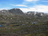
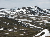
As I started walking the sun slipped behind cloud feathers that were approaching from the south, but it was not obscured all the time. I followed the Alesjaure trail, veering off on a reindeer path when I came to a narrow plateau in the slope, heading straight for the rise of Unna Allagas. I paid some attention to the ground, seeing both an increased amount of leaves and a good deal of low flowers. I made my way up zigzagging on grass between small cliffs, and from the first crest I spotted the Dutch crossing the first stream on their way to Abiskojaure. I went on eastwards atop the ridge, both seeing and hearing rough-legged buzzards in and around the cliffs ahead. These cliffs I climbed without too much trouble, but at some point I hit a "dead end" and had to backtrack a bit. I made my way over to the eastern end, going up the last part from the southeast, and then stood looking at the nice but more or less barren view for a good while. The sun was coming out again, but soon enough it passed into a large cloud bank that was coming from the west, and I started the descent.
I picked my way down the southern side; it was somewhat steep with small ledges, but it was not too difficult. Close to the stream from AllagasjŠvri there was quite a bit of osier, so I mostly kept my distance from it as I progressed westwards through the little valley. For a while it seemed as though the cloud bank would break up, but then it got denser instead. I followed reindeer paths at times, stumbling upon a grassy patch that could support a tent; otherwise the terrain was bumpy and bushy. Ahead of me the sky was growing ominously dark behind RŠdječohkat, and closer at hand I passed a curious ring of stones in the ground. Then I walked on the trail for a short bit, soon turning off towards the little rise immediately northwest of the lake. In front of me there were some reindeer resting on a snowfield, and as I approached they got up and walked to and fro. I ascended the rise from the north, having to use my hands at some point, and then sat down against a rock close to its western end just after 12.
I had lunch at once, looking out over a land of shadow; the sky was covered by clouds save for the remote area around Tornetršsk. There was a bit of wind as well, but it was not chilly. I sat calmly for some time, but when I felt a few drops falling I got up. I went downwards at an angle until I came upon the trail and then followed that for a bit before breaking off towards the "source tarn", and then walked down the next slope. There had been no more drops, and as I was approaching the cottage before 13:00 I thought that the clouds were about to split apart.
« Return to Unna Allakas report


