Thursday 15/7

Čoalmmeoaivi
| Horizontal distance: | 16 km |
| Vertical distance: | +100 m, -40 m, +600 m, -600 m, +40 m, -100 m |
| Time: | 6 h 30 min |
| Lunch break: | 1 h 15 min |
| Dinner: | – |
| Night accommodation: | – |
| Stage classification: | Easy/Medium |
The sun was hidden by a cloud as I walked up the slope, but when I had reached the crest it came out again. The valley between Unna Allagas and Stuor Allagas was pleasant, with long duckboards stretching almost the length of it – although all the bushes did attract quite a few mosquitos. When a small brook came down and crossed the trail I lost the path, but I soon found it again as I started climbing the next slope. Once past the obscuring rise to my left I could see that Abiskoalperna were just touching the receding clouds, and in the other direction Storsteinsfjell was emerging.
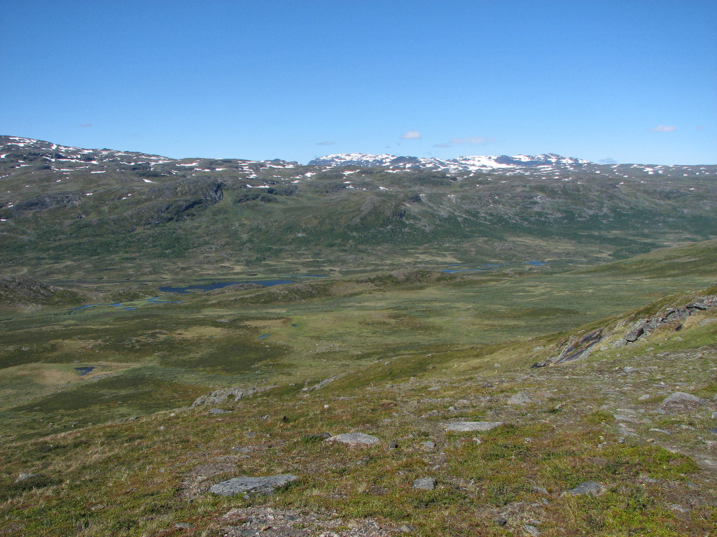
After some wet passages I came out onto Snárapláhku, which is a nice and grassy high plain. Further ahead of me I could see the Swedish couple who had left earlier in the morning, and started giving chase. Now only a few snowfields remained, and those could be circumvented if one so wished. I was now high enough to see Vuoiddasriida/Gorsačohkka to the north, and they were still clouded, with denser banks further off to the northeast. I caught up with the others just as they stopped for a pause, and after talking some with them and being treated to some biscuits of theirs I went on ahead.

Up I go...

...past...

...Allagasjávri

End of Unna Allagas

A look back west

At the crest

Abiskoalperna appearing

Snárapláhku ahead

Abiskoalperna across Snárapláhku

Snárapbákti

Chase
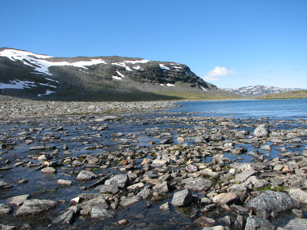
The terrain turned wetter for a bit, and then stony, but one could have put up a tent somewhere if need be. Then it got stonier still, followed by more grass closer to lake 1034, and here the path disappeared. The winter trail markers indicated a passage of this lake in a straight line, which was obviously not intended for summer purposes, and I made my way westwards to the connection between this lake and the one immediately above it. This proved to be a wide and easy ford, but I still had to make a number of course corrections in mid-stream to accommodate my boots.
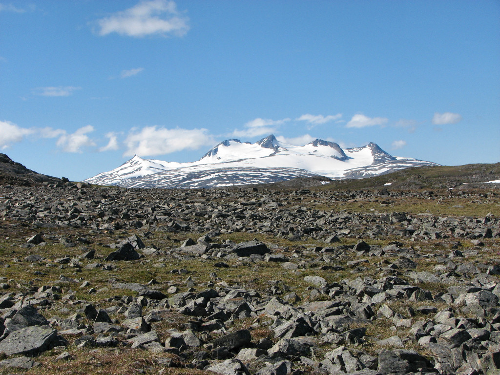
I landed directly on the continuing path and started up the third major slope of the day, which was not so bad – but it was very warm by then. I filled my water flask in the little stream that came down beside the trail, and then broke off to my left. Here the ground was mostly grass, but progress involved winding between/past steeper portions of rock. Now the Norwegian peaks were rising above Snárapoaivi, and after crossing a field of flat rocks and coming up onto the highest part of Čoalmmeoaivi more peaks on the eastern side of the ridge started appearing as well.

At the ford

Bajip Snárapjávri

Smaller stream

Snárapláhku stretching out below

Hirsute blossom

Norwegian peaks rising behind Snárapoaivi
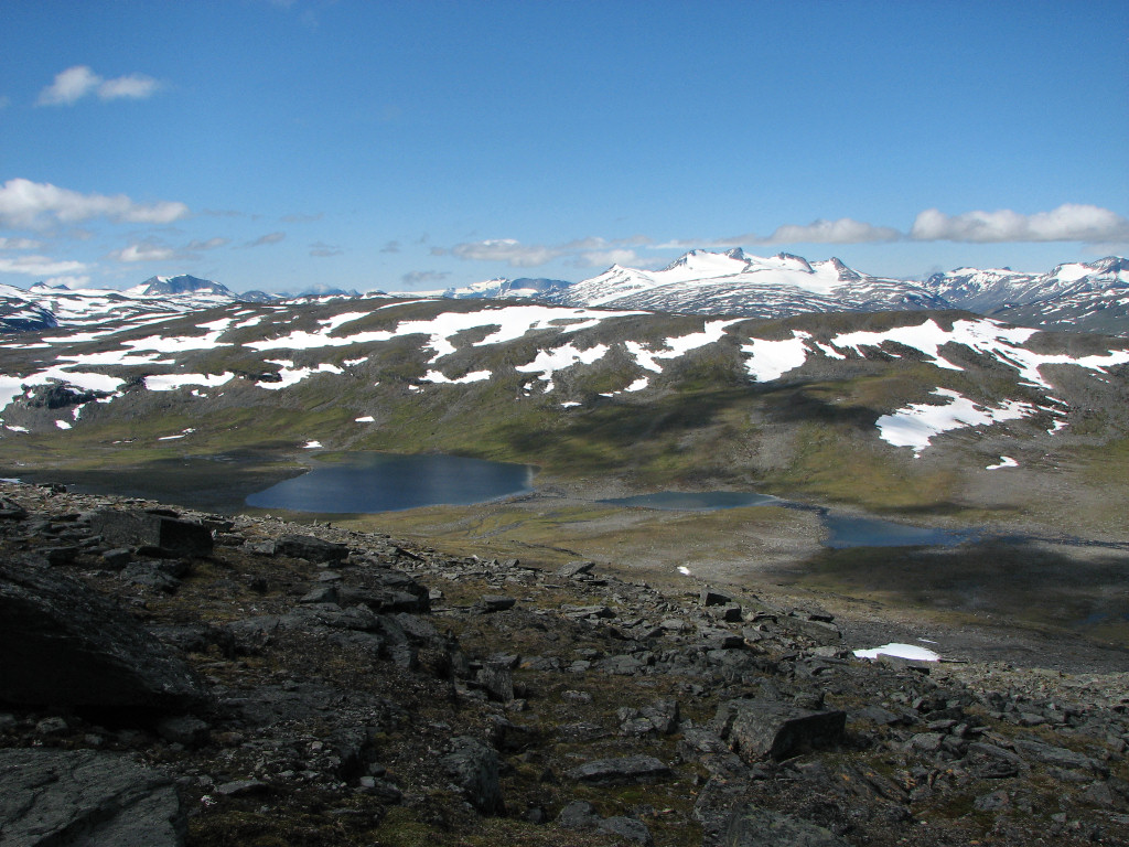
As the view expanded I could ascertain precisely what it was that I saw, and I proceeded down a slight bit to the start of the eastern slope where I sat down upon a rock before 11:45. Here there was some wind, so I put the jacket on. The view was truly spectacular, with a whole range of massifs spreading out before me, and the turquoise Alisjávri below to complete the scene. Fantastic in every sense of the word. Looking the area over with my binoculars I spotted the continuation of the trail, but nothing upon it, and after consulting the map a bit I had my lunch.
More wind was coming, and the sun was hidden by cloud again, so I decided to enlist the help of the fleece jacket. I sat still for a good while, removing the jacket again when the sun reappeared. I saw the other two make their way down into Čoalmmevággi, and then got up to walk around a little. Another use of visual aids revealed the approach of two new people coming up from Alesjaure, but they were far away still. When it was time to leave I kept the wind jacket on, since the wind was still at it, and started up towards the summit.

Steep mountains coming into view

The start of Visttasvággi over there

Áhpparbákti and the east-turning vale of Aliseatnu

Full panorama from northeast to south from Čoalmmeoaivi, with the turquoise Alisjávri below

Smaller panorama of the southern massifs, centered upon Bossosčohkka

The Alisjávri Sámi encampment

The summit of Godučohkka

The waterfall in the stream from Njuikkostakvággi

Alisjávri and Čoalmmeriehpejávrráš

The blind valley of Moskkumoarhmá

The alpine area around Riehppiglaciären and
V Bossosglaciären
Once there I waited for a small cloud that had positioned itself around the peaks of Storsteinsfjell to move off, and then went on south of a tarn into which a snowfield dipped itself. I made my way down the following slope, which in large parts consisted of stones, but there were also small grassy ledges. I walked close by another little brook, later crossing it, and after some more winding the slope started levelling out, and as it did so it got grassier. The wind had now died down, so I took off the jacket and proceeded towards the next lake connection as a helicopter came through the Čoalmmeoaivi/Gárddečohkka pass and then headed westwards. This connection was really easy, and I did not even have to slow down as I walked across it.

Icy

The rounder Swedish side

Storsteinsfjell by itself

Panorama over the Norwegian peaks from Čoalmmeoaivi
Down I go

Pretty heather

Rocks and flowers
Simple!
On the other side the ground was rather stony, but there was grass between the stones, and after a wet passage I was back at the trail. I followed the same way back towards the end of the plain, and looking in this direction I was startled by the sudden appearance of Storsteinsfjell from behind Snárapbákti. As I started going downwards I noted the very agreeable nature of the landscape ahead of me, and the view which opened up westwards was anything but bad too. After coming down the slope I stuck to the trail all the way back home, where I arrived at 15:30.

Gull without sea

Fjelds north of Torneträsk

Passing Snárapbákti again
Storsteinsfjell reappearing

Vuoiddasriida and Gorsačohkka

Crossing Unna Snárabás

Downhill
Two tiers below

Upon the planks

Campsite at Allagasjávri

High view above...

...Unna Allakas
« Return to Unna Allakas report