Sunday 25/7

Ruovssuk cave
| Horizontal distance: | 8 km |
| Vertical distance: | +340 m, -340 m |
| Time: | 4 h 15 min |
| Lunch break: | 45 min |
| Dinner: | – |
| Night accommodation: | – |
| Stage classification: | Easy/Medium |
This outing was to be conducted in the search for a cave that was supposed to be situated at an altitude of around 1000 meters in the slope on the Norwegian side of Ruovssuk. I started out by taking the tarn path, upon or close to which I managed to drop one of the lens covers for the binoculars, but decided to look for it later.
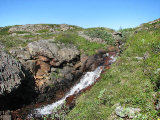
As I was making my way westwards I observed two people going up to the cottage, and since it was early I surmised that they had camped nearby. I came to some grassy pools between which the ground could not support my weight, so I had to go around them on the south side. Then I walked in more or less a straight line aiming for a "corner" in the terrain, again finding the land more than pleasant. There were some weak reindeer paths parts of the way, and when I came to the corner I followed a clear one up beside a brook, and then past a tarn a bit further down the slope I had now reached. I then descended into a shallow ravine with another brook in it, and the path led on to the next one. That stream showed a confluence of two arms just there, and I followed the western one upwards.
After a sharp bend it disappeared underground and I proceeded up on bumpy grass where I judged its course to be. There was some southeasterly wind as I continued upwards on grass with some bushes here and there, and now another (or the same) tiny brook had appeared. Up to the left there was a marked cliff ledge, but as I approached it its southern side turned out not to be as steep as it had looked from below.
I passed it by on the eastern side, going over a little rock field up to a place with two large rocks where I thought there might be caves, but found naught. I continued eastward in the direction of some cliffs in the steepening slope above, and after rounding them I carefully climbed up the other side. I went out to the edge to get a good overlook, and tried spotting an opening from above; I thought I saw something a bit down which might be a snow-filled hole in the ground. I continued upwards a short bit to where further progress would involve actual climbing, and sat down in the soft ground cover at noon.
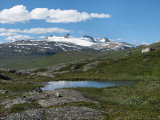
This place was interesting in that water was dripping down the cliff face behind me, and I was sitting on a small ledge in the steep slope itself, with a wonderful vista before my eyes. After eating I used the binoculars to do some more visual scouting, and discovered a couple of people with the ČunojŠvri boat on the shore beside the inflow of RŠdjejohka. There was some wind on and off, but when it was off it was really warm. I stayed until cumuli started obscuring the sun, and then cautiously made my way down on the grassier western side.
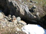
I walked over to the spot I had observed from higher up – and did indeed find a small opening partially covered with snow. Investigating further I found that the opening was fairly wide but rather low; one could slither in, but not much more. The space below went on down at a shallow angle, in under the rock that constituted the ground above, and from what I could tell in the dark it could well extend for quite a bit. I looked around the immediate area some, but found no other entrances, so I slipped in a few meters and snapped some flash shots. I marked the spot with a couple of cairns and then left, feeling somewhat content to have found a cave at least.
I walked down a little bit to better judge the location, and found that it corresponded well with the spot marked "cave" on the map. Then I turned homewards and started off in a southeastern direction, passing another collection of limestone cliffs which potentially could house caves, but did not see any obvious openings. I crossed some brooks on bumpy grassland interspersed with heath, and then went between some low hills to a very nice little hollow; it was fairly wet itself, but just before it there were nice campgrounds. The brook responsible for the wetness exited the hollow in a small groove, and I followed it out.
When it grew flatter I went up to the east and then cut across the slope downwards, going over some well-utilized reindeer paths. I walked below some hills past a little tarn, and as I got closer to home I observed two people sitting in the slope leading up to the guest cottage, and also a tent erected on the campsite. When I reached the place where I had discovered that the lens cover was missing I started scanning the ground, walking extremely slowly the rest of the way up, but never found it. I did, however, find hordes of mosquitos and other annoying insects, so in the end I gave in and covered the last short distance at 14:30.
« Return to Unna Allakas report


