Saturday 24/7

Vuolip GoržžijŠvri/SnŠrapoaivi
| Horizontal distance: | 11.5 km |
| Vertical distance: | +560 m, -560 m |
| Time: | 5 h 15 min |
| Lunch break: | 1 h |
| Dinner: | – |
| Night accommodation: | – |
| Stage classification: | Medium |
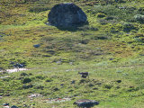
I walked the Alesjaure trail upwards as the veils retreated, and then broke off at the crest, walking on the south side of the little rise. There was a small herd of reindeer there, and after running around for a while they went down towards AllagasjŠvri. I cut across the slope on nice heath under perfect walking conditions, and then came down onto grass. I rounded the next tarn on its east and south side, where the ground first consisted of large stones with grass between them, and then of wet grassland. I followed some reindeer paths past a region of gravel hills, and then came to Goržžijohka which spread out in many courses as it bent. The farthest one seemed rather swift, but as I proceeded upstream I noted that it looked just passable if one really needed to get across.
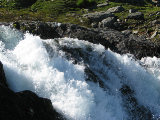
I had no such need, so I turned my attention to the mighty fall which I had seen from a distance many times before – and mighty it was indeed. I climbed out of the hollow I was in via a gravel slope partially covered in grass, and then kept close to the water, which at times involved finding a way between flat rocks. I came up to a plateau at the far end of which there was a fascinating wall of rock over which several smaller falls dropped. I misjudged the next climb and had to go around a bit to reach the top, and then went out to the start of the falls for a titillating look over the edge. After that I followed fragments of a path – and suddenly the reindeer-watching hut appeared. ATVs were parked outside, and I saw someone there as well, but when I walked up everyone was inside.
It did not take long before one of the SŠmi came out again, however, and I chatted with him for a while; he thought their reindeer-related work was going well, but he also said that tagging the calves was difficult in rain – something we had had ample quantities of this summer. They had worked through the night and were to pack up and leave for AlisjŠvri the coming night, so I was lucky to have caught them. Eventually I walked on, first upon ATV tracks and then grassy/stony ground – and clearly this was were one should cross Goržžijohka if one wanted to.
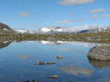
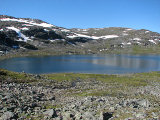
Vuolip GoržžijŠvri was like a mirror, and I walked close by it until I saw a flattened rock islet a short bit out into the water. This water was so still and clear that I had difficulty judging the depth, but with some careful stepping in a not-too-straight line I managed to get out there and sat down on soft moss and the like around 11:45. I put on the wind jacket, but it was calm for the most part – and warm. After eating I sat still, looking out over the lake, and even lay down for a while. Birds were swimming around on the water, and I observed them for some time. Then the wind picked up anew, causing ripples on the surface, and I thought it best to get moving again.
I walked close to the water, after a bit on soft grass/moss, and soon miniature brooks started coming down from the left. The wind had abated once more, and I walked calmly. I had had a simple route in mind, but on a whim I now decided on something more complex and broke off up the slope at an angle, increasing my step. I crossed a babbling stony brook the outflow of which included a tiny strip of sandy beach. The ground then turned to stone followed by drier heath/earth with some reindeer paths on it. Below me was a nice-looking tarn, and after going out to an edge in the terrain I turned straight upwards, making my way between the rocky parts. The view over both Vuolip GoržžijŠvri and all the peaks of primarily Norway was stunning, and then the former was temporarily hidden from view as I went up to a little top from the southwest.
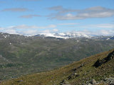
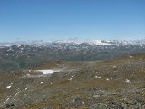
From there I had a very wide and far-reaching view of both Sweden and Norway, and I thought it was at its very best in the northwestward direction, towards SealggajŠvri. Mmm. I stood there for a while, but the wind was chilling, so soon I started down the northern slope. Here it was steep indeed, and I had to be very careful. The uppermost part I could cross on a snowfield, but nearly slipped in doing so, and then I could pick my way down with some minor troubles. After that the ground was grassy and nice, and I could walk unhampered.
I passed east of a large and surprisingly thick snowfield, and as I did so I observed the ATVs going eastwards some distance ahead. I came up onto a new rise followed by a similarly tricky descent, including a minor setback, and after walking on snow beside a tarn I passed between two smaller ones, where walking was very pleasant. I went up onto yet another rise – this one being round and consisting of cliffs – and then down past some steep sections, again managing with some hassle. I walked west of another tarn and then out onto the crest overlooking the valley below, from where I as usual saw nothing in my binoculars.
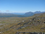
Going down was easier than expected, and the ground was mostly covered with grass at that. I went past/upon low ridges of gravel and heath and/or grass, and after crossing some very well-trodden reindeer paths I passed west of the tarn this time. I walked over to the start of the next downward slope, where the shrubs were somewhat higher (but still low). I proceeded down at a shallow angle, passing more mining traces, and when osier took by I could easily circumvent or pass through it until the cottage came into my field of view rather abruptly. I went down to the Norwegian trail, coming onto it just at a spot which looked like it could hold a tent. From there I walked on the path, which I thought was somewhat less muddy than before (which still involved a good deal of mud), returning to the warden's cottage after 15:15.
« Return to Unna Allakas report


