Thursday 1/7

Sjangeli
| Horizontal distance: | 10.5 km |
| Vertical distance: | +240 m, -240 m |
| Time: | 5 h 15 min |
| Lunch break: | 1 h 15 min |
| Dinner: | – |
| Night accommodation: | – |
| Stage classification: | Easy/Medium |
| Map point: | Sjangeli |
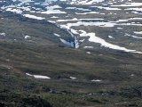
I walked briskly along the trail, circumventing the shrinking snowfields, and after passing the stream I followed the path leading up on the west side of Ruovssokjohka, coinciding with the winter trail markers. This path grew fainter as I progressed, but when it appeared to want to cross Ruovssokjohka I thought the water looked too deep, so I went on upstream. In that direction it was only getting worse, however, so soon I turned down again, sticking close to the stream scouting for a suitable place to cross. I did find a spot where it looked possible, but in the end it proved just a tad too uncertain; not in general, but since I had no sandals with me I wanted certainty. Then I sighted another place just where Ruovssokjohka breaks up into several courses, and here I could get across by mostly stepping on large stones. This landed me in dense osier thickets, and after striding a minor canal I picked my way upwards as best I could, soon coming to an area of grass and shrubs where tenting would have been possible.
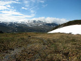
From there I started up the slope in a northeastward direction, taking off the jacket in the increasing warmth. Towards the east Abiskoalperna were just touching the clouds, and the peak of Godučohkka was hidden. The slope had a fair bit of flowers in it, and I did my best to note as many as possible. Further up I saw mining traces in the form of what looked like an old road, and as I proceeded towards the rise ahead more rubble started appearing. I had to go up around a larger quarry, and then went down a bit again to the ruin I had seen on my way to Unna Allakas a week earlier. This was but a skeleton, and after snooping around it a little I climbed up to a cairn marking the circuit seen on the map, but found no footpath there.
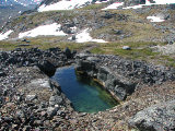
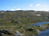
I followed the markers until I lost them, and then aimed for the next rise, and when I spotted the buildings at Sjangeli I found them again. SkŠŋgalanjŠvri was still partially covered in ice, and it was both windy and chilly. I was now in the middle of the main mining site, and there were several inclosed holes in the mountain, one of which seemed rather deep but was filled with snow. I then proceeded over to the old stone buildings, walking up to the nicest-looking one at 12:00.
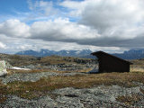
I started out by reading the information board on the wall and looked around a bit, and then sat down in the shelter of a nearby ruin and had lunch. Sjangeli has been the site of copper mining operations at several times since the 17th century, but never have they been worth the effort due to the remote location. The stone buildings found there have been restored, and in the vicinity several other ruins and foundations can be seen – and across the outflow of the stream from SkŠŋgalanjŠvri there is a modern tourist facility belonging to the local SŠmi, but it does not seem to be used much nowadays. After enjoying the warmth for a while I got up and walked over to the eastern edge, looking at the view, and found some more traces of the days of yore. I then sat down atop one of the ruins, but when the wind blowing across the lake got too cold I prepared to leave. Before doing so, however, I scrutinized the North SŠmi text on the board, to the sound of the seagulls swooshing around.
I started out by checking out the tourist facility, and found it to be pristine as well as completely locked up. I followed a path leading through it and beyond, but then it faded and gave way to wet ground by a melting snowfield which I passed close to the shore of SkŠŋgalanjŠvri. A single marking cairn later I was on the main trail to Riksgršnsen/KatterjŚkk, and the wind was not so strong or cold as it had been on the other side of the lake. Upon the trail were the tracks of reindeer, but also those of boots heading north, so there were at least some creatures out and about. It was sunny and fair as I walked southwards on mostly grassland which would have been rather nice had it not been so wet. When the land started sloping downhill the wind returned in force, but the shallow vale ahead of me was very inviting still.
Clouds were still billowing over GŠllančohkka and NuorjjovŠrri, and those over Abiskoalperna were persistent as well. Just after passing a brook I found an excellent campsite with a terrific view, and noted it for future reference. The terrain consisted of nice, dry heath and came in the shape of small terraces. The path had sunk deep through the soil, however, so I often walked on the side, which I was not sorry for. On the whole I found the slope very beautiful, and I took my time going down.
At the bend of the trail there were clear indentations in the ground from snowmobiles, and from there I followed a path down alongside Ruovssokjohka. After a while it dwindled, and I took to natural openings through the osier, soon coming onto what looked like an old, overgrown path, and before too long I was back at my previous crossing point. The water looked a bit higher now, and I had to take a slightly different route at the start, involving a little leap, but then the rest of the crossing was simple. On the other side I found a fairly clear path leading down to the next stream, and after that I turned off behind the small hills there, at times following small reindeer paths across heath and low shrubs. I also passed a cloudberry mire that would surely produce a bounty later on, but as of yet there were only flowers. I proceeded over to the smaller path going between the tarns, and took that up to my cottage shortly before 15:30.
« Return to Unna Allakas report


