Tuesday 16/8

I did not sleep very well, at least not at first, and the rain continued through most of the night. When morning came it had mostly petered out, but as I got up around 07:45 it was back to wind-drizzle, and the clouds remained very low. This was not according to neither plan nor prognosis, but checking the latter again – my phone could just get a signal – it remained the same, so it was likely that the weather was to improve markedly during the day. There was indeed a noticeable change before long, with patches of blue sky being revealed, but since the clouds still had a few bouts of light rain left in them I had my breakfast inside as the last of it passed. The surrounding peaks were showing more and more of themselves, but thick clouds were drifting past them even as the rest of the sky slowly cleared. I made a visit to the privy, saying hi to another lone hiker up at the shelter, and then left wearing the wind jacket after 10:15.
I crossed the stream at the alternative location I had seen the day before, and even though it was still easy the water was appreciably higher from all the rain, especially visible at the stone slabs. After climbing the steep sand brink on the other side I found myself on a large flat plateau where progress was easy, although I was feeling a slight pain in my left knee the first signs of which I had noticed after lunch on day 1 – and I immediately thought back to the hardships of the Kebnekaise–Ritsem tour. The sun made brief visits as I approached Ulvåtjärnen, which has several small stretches of beach for the bathing inclined, and ahead of me the Sylarna massif was still entirely clouded.
The trail was now pretty muddy and what duckboards there were were in very poor condition. A while later the path dwindled as well, and I realized that I had inadvertently stayed with the winter markers when the summer trail took a slightly different route, so I walked over to the latter and found easier going again. The clouds were slowly shrinking and the sun exerting its power more and more as I approached the Enkälen shelter, where already from a distance I could see a number of people were gathered – and when I walked up more appeared behind the new buildings. Most of these were having a food break, but I contented myself with a little pause and some chocolate before moving on.
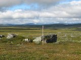
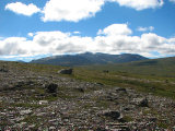
I was now aiming for the Sylhyddan ruin near Enan on the other side of the gentle rise of Enkälen proper, and after looking closely at the map I arrived at a suitable heading based on visible landmarks. I started off by crossing a largish wet mire, which went well, and then ascended the subsequent mild slope, in full view of more and more people who were coming to the shelter along the Sylarna trail. The ground was uneven and varied in its nature, and I chose suitable sub-routes while keeping to my larger-scale heading as best I could. The sun was now shining almost constantly, and the view to the northwest and in over Norway was just stellar. The knee was giving me some trouble as I started the descent, though – as expected, unfortunately.
When I could see the course of Enan clearly I took out the map again and reoriented myself, finding that I was indeed on the right track, and set a more specific course for where I judged the ruin to be among the little hills that made up the landscape closer to the stream. After going down the remainder of the slope I went around a couple of said hills and suddenly found myself on an old path – and moments later I came to the metal sign marking the location of Sylhyddan. Well aimed! Save for the plaque the only remaining trace of the old building is a corner of the stone foundation, which would otherwise easily be missed. Sylhyddan itself was the first tourist facility built by STF in Jämtland way back in 1890, and can now be visited at Jamtli in Östersund where it has subsequently been moved.
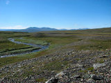
I continued down to the shore of Enan through a steep strip of forest, and found the stream to be fairly swift. My main idea for the tour involved crossing it somewhere in the vicinity, and even though it certainly looked possible, it didn't look too favorable right there, so I started following it upstream. The vegetation close to the water was dense and bushy, so I soon took to the slope again, returning when it flattened out temporarily. It was now after 12:45, so I sat down on a rock and had lunch in the sun, watching the sparkling water – and Sylarna, which had shed most of their cloud cover.
I then continued tracking the stream at various distances, investigating several possible crossing locations, but found none that looked really good. During this I also managed to sprain my ankle for real, albeit lightly, and had to stop to rest for a bit. The pain quickly subsided, however, and I gingerly picked my way back down to Enan at yet another promising place, this time where the stream widened out in a large bend. After looking it over I decided to try it, and changed into the slippers.
The first bit was easy enough, and the current largely nonexistent, but then I came to a portion that was deeper than comfortable, so I retreated to a group of larger rocks in the middle of the stream. From there I visually planned another route across the remainder, and removed the trousers as well to have larger leeway. The second attempt also had me arriving at a short stretch that felt just a tad deep, but looking closely at the bottom I managed to find a way around it, with the water never going higher than the middle of my thighs, and I soon stepped onto solid ground. Yeah!
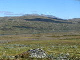
I kept the slippers on as I cleared the moist area close to the stream and climbed onto a nearby hill, where I sat down in the heath to change back. The water hadn't been too cold, but it was still nice to rest for a bit while I considered my next move. In the end I decided to press on for the Norwegian border and see how it felt, so I set off at an angle up the eastern slope of Fiskåhöjden. The terrain here was pleasant both to look and walk upon, and I trekked in and then above a wide, shallow gully, playing catch with a curious reindeer on a similar trajectory. There was no wind for the most part, and things were therefore rather warm.
When I reached the trail to Storerikvollen I stopped to have a look at the map, and then went on westwards above Fiskåtjärnen. The ground here was wet and bumpy, and my knee was protesting every nth step. It was starting to feel late – not in absolute terms, but it felt as though I had been walking all day already – and my initial plan of reaching Syltjørna this day seemed less and less attainable, especially considering my unexpected physical condition. I thought that I should in any case cross the start of Nørdre Fiskåa, so after passing the tarn and the adjacent reindeer-watching hut I turned down. The first two arms were passed without much difficulty, especially the second one, and then I came to a crest overlooking the third. I had thereby just passed into Norway, and it was now time to make a decision.
I took out the map again, and looking directly at Sylarna from this vantage point a plan slowly started to form in my mind. I was to scrap the Norwegian side entirely this time, and instead aim for a semi-high camp here on the northern side of the massif, poised for an attack on Lillsylen the next day from this direction; this would also shave a full day off the tour due to the shorter total distance, while still including the Sylarna fjeld station.
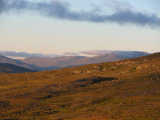
Having arrived at this decision I merrily crossed the remaining course of the stream and made my way over to the prominent border cairn (Rr 155Ba), and then continued up the slope. As I ascended Esandsjøen finally came into view – the Norwegian vista had thitherto been somewhat limited, but now Lopmesvaerie rose majestically in the distance beyond the water, making for a very fine scene. I went on for a bit after crossing the trail to Nedalshytta, and after some walking to and fro across the bumpy, slanting land I found an acceptable spot with a perfect view after 16:30, and started pitching the tent at once.
As I was finishing up I saw two other people coming on the trail from the east, but they turned up the slope as well before the series of streams coming out of the valley between Nordsylen and Vaktklumpen where I now was. I then walked over to the closest of these larger streams to have a good wash, and I also found a smaller brook closer by the tent to use as a freshwater source. The others were making camp too, but the distance was such that there was no contact, sign-based or otherwise. I then prepared my dinner and ate it sitting on a nearby rock in full sunlight and a weak wind, with a terrific view before my eyes. Aaahh.
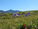
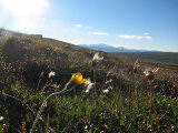
After sitting there for a good while I moved inside the tent; the slant was noticeable, but not bad, and I had carefully aligned the thing so as to keep my head high. Fresh clouds were forming fast over and around Lillsylen et al as evening fell, but I took this to be a common temporary effect and not ultimately detrimental to my plans for the morrow. Instead I enjoyed a nice walk through the immediate area, finding a good number of flowers still in full bloom. I also found an alternative campsite which look somewhat more level, but it did not offer quite as good a view, so I felt no regrets. A single person had passed by on the trail below, and judging from the size of their pack I took them to be a runner, a supposition which was confirmed when they picked up the pace and soon disappeared around Vaktklumpen.
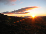
It was a very fair and beautiful evening and after reading for a while I enjoyed a colorful sunset over Esandsjøen – something I had hoped for beforehand, so I was glad that I got to experience it also with my new plan and circumstances. I had my evening snack inside and then went out again to catch the last rays of the sun – just great! The clouds covering Sylarna were now an unbroken shield some 200 meters above, but the base was no longer sinking. I read some more and enjoyed the still, quiet evening, and as I prepared for bed the clouds started breaking apart. I turned in around 22:15 again, feeling somewhat weary after a full day.


