Monday 15/8

Enafors – Ulvåtjärn
| Horizontal distance: | 16.5 km |
| Vertical distance: | +650 m, -50 m, +20 m, -350 m |
| Time: | 5 h 15 min |
| Lunch break: | 30 min |
| Dinner: | Couscous with mushroom soup and cashew |
| Night accommodation: | Tent |
| Stage classification: | Medium |
| Map points: | Snasahögarna, Ulvåtjärn |
It was overcast and chilly in the city, but the sky grew clear as the train headed west. The situation was reversed after Åre, however, and by the time I reached Enafors clouds were touching Storsnasen and the higher peaks. Two other people and a dog disembarked and set off at once, whereas I fiddled a bit with the pack as usual before leaving after 09:15.
I walked along the side of the road, meeting the odd car, and thought that the rucksack felt pretty good from the start. Just after the bridge over Enan the trail I was to follow dived into the forest, where I passed an older couple at once. Said forest was of a nice, verdant variety dominated by spruces, and the ground was still damp from the recent rains. I walked a short distance behind the dog-couple for a while, and then overtook them as they stopped to let me pass.
As I emerged onto the extensive mires stretching out between the road and the foot of the mountains the view of the latter opened up. It was now entirely overcast, but no rain on the approach – as of yet. Duckboards were laid out across large portions of the mires, but many of them were in bad condition. Back in the forest I passed an area showing clear signs of animal husbandry – probably what the map calls Snasahögvallen – and then I caught sight of a small cabin at the start of the steep slope up to Ingolvskalet.
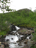
Scaling the first part of the slope was arduous work, and I can see why this trail is no longer regarded as a winter trail due to the avalanche danger – it used to be, and the actual marking poles are still there, but nowadays the stretch is marked as a summer trail only on the map. I met a single man coming down, wearing only a light pack, and passed several waterfalls of various sizes in Ingolvån, but I can't be sure which was the actual silver one. I felt a droplet or two from the all-covering clouds, but no more than that.
Once up in the shallow dale the path deteriorated quite noticeably, but the direction was clear and progress was not difficult. I spotted a hare hopping along a short distance ahead, and also a few reindeer (who were not hopping). When there was wind my bare hands felt a bit cold, but otherwise walking was more or less comfortable. When the path and the naked marking poles (where present) crossed the stream I did so as well, and came into a region of small stony hills. Just as the vale of Norder-Tvärån between Storsnasen and Norder-Tväråklumpen was coming into view I made a wrong step and almost sprained my ankle, but saved myself in time. The wind was now chilly indeed, and I therefore descended a short bit to find good shelter next to a small outcropping with the side valley right before (and below) me.
It was precisely noon when I sat down and put the down jacket on and had my lunch. Lower clouds were now drifting in from the west, at times hiding Sönner-Tväråklumpen entirely. This made the air colder, so when I got going again I put the gloves on. A short distance above, right beside the trail, the other two were having a lunch break of their own, with the dog (a fluffy Samoyed) looking more comfortable than its masters in the cold wind. Not long thereafter I reached the Snasahögarna shelter, which is one of those that had been replaced with a new building during the previous winter. The clouds were now lighter again, and the stony continued path southwards was marked with cairns.
Said path was, however, in poor condition more often than not, with frequent wet patches, and the cairns were loosely spaced. The clouds soon came back in force, and in the distance ahead of me was a dense haze that looked suspiciously much like approaching rain – the weather report had spoken of light rain later in the afternoon, but if this was it it was early.
Just after I had passed the stream from the pass between Sönner-Tväråklumpen and Getryggen (Goat's Back) I noticed a shift in the weight on my back, and moments later I heard the unmistakable thud of the tent hitting the ground, having slipped from its supposedly secure location under the lid. Since the haze was now almost upon me and I could feel the first light drops confirming the earlier suspicions I took the opportunity to change into the rain jacket and put the rain cover on, but since it was so light I stuck to the hiking trousers. My first attempt at fastening the tent better was met with limited success, but the second one worked, and I pushed on in a very light drizzle.
The condition of the path had improved somewhat, but the ground was still fairly wet at times. After a while the drizzle all but petered out and it got warmer, so I opened up and removed the gloves. After the connection with the trail from Rundhögen the land grew more uneven with low ridges stretching along southwards as the path slowly descended, and it was not long before I could discern the Ulvåtjärn shelter. Since I had made good time I thought I might just as well walk all the way down there and make camp in the vicinity, so I did just that. I walked upon a few of the ridges, having another near-spraining experience – damn – and as I was drawing close the drizzle started up again. A number of people who had paused inside the shelter were now restarting their respective treks towards Blåhammaren, and when I arrived at the little hut myself at 14:30 I noted the presence of a large group of youngsters on a plateau just below.
The shelter itself had not been replaced and was still the same as during my previous visit more than a decade ago, but the outbuilding looked somewhat new. I placed my rucksack against the wall and walked round the premises, checking out the ford of the stream that develops into Stor-Ulvån; this was fitted with stone slabs under the surface, and there was a nearby place where the bottom provided an even simpler crossing. Two people were just coming down to the stream and prepared to cross, while the group was leaving in smaller bursts. It was now raining lightly again, and after sitting down for a while feeling the sores of the First Day® staying the night here felt like the right call, so I went back down to the stream and pitched the tent at a perfect patch of grass just by the water which I had found earlier.
I spent some quiet time inside the tent as the drizzle continued, now coupled with a bit of wind, and a bit later it turned into more outright rain for a while. More people were passing by, some more lightly equipped than others, and a family of four plus a dog appeared to take up residence in the shelter. The weather continued to be wet and dreary, with the clouds hanging lower than ever, so I just rested until it was time for dinner, all the procedures surrounding which I carried out inside the tent.
I continued to rest and read, being distured by a single reindeer that waded across the stream, passed the tent by, and moments later came running back; luckily it managed not to trip on any of the guylines. I took care of the (rather light) dishes during a period when the rain had almost stopped, by which time a couple of people were pitching a large tent on the abovementioned plateau halfway between my tent and the shelter, and it took me a little while to realize that it belonged to the family who would not be occupying the hut during the night after all. The rain wavered back and forth in intensity during the rest of the evening, usually staying at the low end of the scale, and I read as long as the failing light let me. When I went to bed at 22:15 it was gloomy indeed, much owing to the dense low clouds, but it was not particularly cold.


