Friday 12/8

Sälka – Neasketvággi (via Čuhčavággi)
| Horizontal distance: | 21 km |
| Vertical distance: | +200 m, -200 m |
| Time: | 6 h 30 min |
| Lunch break: | 30 min |
| Dinner: | Beef casserole with rice |
| Night accommodation: | Tent |
| Stage classification: | Easy/Medium |
| Map point: | Sälka |
I got up at 07:00; the clouds were a bit low and it was blowing a little. When I left at 09:00, the girls were still in bed, and I was apparently the first one to head south that morning. After a couple of kilometers, I entered an area of very light rain (which was highly localized), so I stopped to put on the rain cover.
I was planning on following the trail to the Hukejaure cottage, which was supposed to branch off of Kungsleden about 3.5 km south of Sälka. I never found that crossroads, however; I noticed no path going off in a westward direction, and I saw no sign marking it either. A while after crossing the reindeer fence supposedly just a few hundred meters before the branch, I started comparing the map and the terrain, quickly coming to the conclusion that if there were a trail, I had passed it. I therefore started cutting across the land towards the stream, in the approximate direction of the bridge I hoped would be extant.
As I was approaching the stream, I spotted a ruined hut that was marked on my map (but not on newer ones), being situated just south of the bridge. And, sure enough, after clearing a few hills I saw it. There were a few paths leading in different directions just at the bridge's landing, but I still couldn't detect the "main" trail there.
On the other side of the bridge, on the other hand, there was a distinct trail leading into the considerably more vegetated Čuhčavággi. I hadn't gotten very far before water-heavy clouds descended and started disposing of their load. I persisted for a while, but the rain's intensity increased and I was forced to stop to change into the rain clothes.
Shortly afterwards, I saw a couple coming from the east, but their course was noticeably higher up in the slope than mine. Since the path I was following wasn't much of a path at that time, I started climbing and soon came upon the actual marked trail, which I must have strayed off a bit back. The couple had walked from Hukejaure and they said that it had been raining all the time. I pressed on in the wetness, but the low clouds soon started to dissolve and the rain petered out.
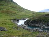
I lost and found the trail a couple of more times, and then I saw two more persons crossing the water ahead, realizing that I had come further than I had expected. Down at the ford, which is not marked as such on any map, I found a sturdy walking stick that someone had left behind, intentionally or not. Aided by both that one and my old, thin stick, I attempted the crossing, only to find it too troublesome. I therefore walked upstream a bit, somewhat stressed by a new batch of rainclouds drifting in from the east, before I made another attempt. This time I was successful, but it was on the very verge of what my boots could handle, and the sticks were of absolute necessity as it involved extensive balancing on slippery stones.
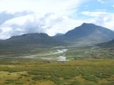
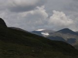
Having landed safely on the southern side, I wished to stop for lunch as soon as possible. Luckily enough, there were a series of rocky rises close by, and the nearest one had an outcropping away from the wind, providing adequate shelter. I reached this little refuge at 12:30 and paused there for half an hour. By the time I was ready to leave, the rain had very nearly ceased again. I started to climb the rises, heading southeast towards the tarns below the northern face of Unna Ruškkaš. The following two pictures are taken from the windy top of the first rise:
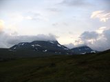
Upon reaching the smaller tarn, I discovered yet another marked unmarked trail, with cairns and footprints. It is always encouraging to see that other people have journeyed somewhere before you, no matter your orientation skills. I followed the path past the last tarn and up a small slope, and then stood looking out over the rich, inviting Neasketvággi. To complete the scene, sunlight emerged for the first time of the day.
As the pictures indicate, the western end of the valley consists of a sheer wall. The descent would have been problematic had it not been for the path's persisting in being discernable, leading down the northern slope in a fairly leisurely fashion. I stopped near the top and changed back into my wind dress, accompanied by a swarm of mosquitos in the newfound sunshine. Since walking in rain clothes typically makes you as wet from the inside as you would otherwise get from the outside, I was positively surprised to find that I wasn't perceivably damper underneath than I normally would have been in dry weather.
Down in the valley proper, the ground was all grass. Walking through the soft land of Neasketvággi, after so much rock and stone and water, was almost pure joy and I covered a lot of ground in a short time.
The path stayed up on the plateau of sorts that constitutes most of the northern side of the valley, forgoing following the stream at the actual bottom. The plateau was interrupted by a few brinks, so that it could be said to be divided into tiers. After going down the second of those brinks at 15:30, following a circular reindeer fence, I saw a sizable tarn a good way down, on the level of the stream. This put me in a dilemma: I had by then gotten far enough to see the landscape beyond the valley, and I much desired to retain that view while camping (both for the sake of the beauty of the view itself, but also because I would have a better capability to judge the cloudiness the next morning, for a potential ascent of Giebmegáisi), which descending to the tarn would preclude – but the upper slopes seemed entirely devoid of water, running or otherwise.
Unwilling to compromise, I left the rucksack in the heather and went on a scouting tour. After a good deal of wandering about, I did find a small rill which I could utilize a little bit further east (and further down), and I went back to fetch the rucksack. There was a low rise beside the rill from which I had a partial view of the eastern fjelds, but I still wasn't satisfied, so I went for another tour, this time concentrating on higher ground. And, finally, I came across a small trickle right by the footpath, with a flow just barely enough to count as running, and a depth not greater than an inch or two – but it would do. Once again, I went back and brought my belongings to the new location and proceeded to pitch the tent just before 17, followed by dinner.
I had a splendid view from the camp site, and the sun had established a firm dominion of the skies. It was a lovely afternoon, especially after the somewhat depressing forenoon. Unfortunately, the mosquitos also found the place a nice hangout, so my repellant had to show off its abilities some more.
After dinner, I entered the tent and, right after doing so, thought that I heard the sound of rain on the outer canvas. However, when I had listened a while (and stuck my head out for confirmation), I realized that the sounds were made by hordes of insects impacting with the stretched fabric. I had tried my best to be as quick as possible when getting into the inner tent, but a number of mosquitos still managed to slip inside, so I had to do some hunting.
The sky became increasingly cloudy as the evening progressed, but it was still rather fair and peaceful. I had my evening snack, went to bed at 21:45 and lay reading for a while in the fading light. Later, when I was trying to sleep, I was disturbed by two kinds of birds: one which made prolonged raucous noises, and one which simply shrieked. In the end, they were unsuccessful.


