Sunday 7/8

Ballinvággi – Pieggaluoppal
| Horizontal distance: | 18 km |
| Vertical distance: | +140 m, -360 m |
| Time: | 6 h 30 min |
| Lunch break: | 30 min |
| Dinner: | Spaghetti Bolognese |
| Night accommodation: | Tent |
| Stage classification: | Medium |
| Map point: | Pieggaluoppal |
As is usual when spending a night out in the open, sleep was not continuous. I woke up for the last time at 06:00 and lay relaxing for another 45 minutes before getting up to make breakfast. Upon opening the ventilation flap and looking out, I saw nothing but white – due to the valley's altitude, I was in the middle of a cloud. I could see no further than to the edge of the little plateau, but a clear sky beyond the mist could be perceived at the zenith. While cooking, the cloud seemed to dissolve somewhat, but soon condensed again. This cycle was repeated one more time, so that when I had packed everything up the world was still all white.
During these almost-clearings, I debated with myself whether to continue through the valleys as I had planned, or to go back down to Kungsleden, thereby in all probability exiting the cloud and restoring vision. I did not like the idea of turning around, both due to a general opposition towards retracing steps and because such an act would feel like something of a failure. On the other hand, the prospect of fumbling along through the mist, finding my way across uncharted territory, including fording one or more non-trivial streams, did not seem all that attractive either. Adding to my sense of insecurity, I then heard a prolonged sound which I would identify as stones sliding down a sheer slope – a rock avalanche, if you will. However, at 09:00, just when I had donned the rucksack and was – physically – ready to leave, the sun broke through, setting the persistent cloud moving upwards and inwards, so I quickly resolved to proceed as planned.
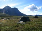
Having crossed most of the length of Ballinvággi, I spotted the tent of the two men from the day before. They had occupied what seemed to me the only other reasonably suitable camping site, at least on that side of the stream; the terrain was very stony. I also spotted the men themselves, who were picking their way towards the glaciers, so they were obviously planning on staying in the immediate area. I, however, forded Ballinjohka where it again split into many courses, which took some time to do.
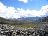
Continuing through the nameless valley between Čoamohas and Ballinbogičohkka, I soon came across fields of rocks which through the aeons have been broken off the mountain faces. Passing over such ground is seldom straightforward, but presented no immediate problems. Rain would have made matter much worse; as it was, the sun was shining for a clear sky. Before long I had reached Šiellavággi, and was presented with a choice: go northwest, downwards, and come out on Kungsleden at the Kieron cabin, or go southeast, upwards, eventually reaching another trail. With the weather being the way it was, and my spirits severely lifted (the shadow of yesterday's evening was altogether gone), the decision was already made: up!
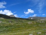
Once I got into Šiellavággi, the wind picked up. Not too much to worry about, though, since the air was rather warm. As can be seen in the image of the valley above, the slopes grow rather steep as they approach the central stream, Šiellajohka. Consequently, I maintained my elevation as I proceeded up through the valley. For the first part, before reaching the first tarn, the ground consisted of soft, lush grass, although tenting was pretty much ruled out due to the heavy slant (not that I was planning on tenting there anyway). There were faint traces of a path here and there, which I followed whenever it appeared, but it was easy going anyway. A bit before the aforementioned tarn, at 11:30, I paused for lunch.
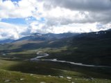
After the tarn, there was nothing but rock fields again. Some bits were easier than others, but going was moderatly demanding all the way, and it was sometimes necessary to visually plan a particular passage in advance, before attempting it. Finally, I reached the highest point and started to descend into the vast valley through which Aliseatnu flows. At first the rock persisted, but it gradually gave way to grass and heathland. After a while I reached the last fairly steep, overgrown incline, from the top of which I had a magnificent view of the landscape ahead.
I could now see – or at least guess at – the marked trail that goes beside Aliseatnu. Picking my way down the slope, serpentine fashion, I suddenly came across a cloudberry heath, and obviously had to stay a while to pick a fair number for prompt consumption. There's really nothing quite like fresh cloudberries... Down on the trail, I turned west, heading for what the map claimed was a shelter by the name Pieggaluoppal some kilometers away. I met one lone man going east, but otherwise I was still alone.
I reached Pieggaluoppal, which was indeed a shelter, at 15:30. It was situated right where Áhpparjávri is connected to Bieggaluoppal through a series of rapids; a rather beautiful location. The shelter itself was of the usual kind, with two wooden bunks and a small firewood heater, but also included support structures in the form of a privy, a (nearly empty) woodshed and litter compartment. I dumped the pack and walked around the premises for quite some time, enjoying the nice (but by then rather windy) weather and the splendid views. I also scouted for a suitable tenting spot in the direct vicinity of the shelter, and subsequently found a rather good one. Having pitched the tent, I set about cooking dinner on the lee side of the shelter at around 17:00, and then went inside to eat.
"In a dream, I saw the eastern sky grow dark, but in the west a pale light lingered..." Ok, perhaps not quite so, but dark clouds were drifting in from the east in the evening, and the wind grew stronger. I was sitting in the shelter, massaging my feet, when a pair of young German women arrived some time before 19. They had started from Kaisepakte, in the northeast, a couple of days before and had had a somewhat rough journey – not regarding the weather (naturally), but regarding the condition of the path: they said that they had known "nothing but mud". Feeling a bit relieved at reaching the most agreeable Pieggaluoppal, they planned on spending the night in the shelter itself. Thus, even though I was going to sleep out in the tent, I got company for the rest of the evening, which was rather pleasant after two days of solitude; we discussed itineraries, hiking in general, the weather, Sámi names and language, etc. etc.
When you go on a long hike like this, you take great care not to carry more than you have to. It was, therefore, a bit of a surprise to see that one of the women had brought a mini guitar(!), with which she and her companion provided entertainment. It was all in German, and even though I usually find that language... less than savory... the pair of them clearly knew how to sing, and the whole experience was quite genial. They went on to attempt the preparing of some Austrian specialty on their gas-powered camping stove, which did not go as well as they had hoped, although they did concede that it was a bit of an experiment in the first place. Let's just say that their washing-up was considerably more extensive than mine...
Later in the evening, the more nasty-looking of the clouds had passed without doing anything, and the weather was again pretty fair, but the wind remained in full force. I read a bit in my book and had an evening snack before saying good-night to my impromptu companions, and went to bed at 22:00. Throughout the night, the wind blew strongly and it rained quite a bit, but my tent took it all in stride.


