Tuesday 8/8

Tuottar – "Tarraluoppal" (via Skiejákvárásj)
| Horizontal distance: | 17 km |
| Vertical distance: | +140 m, -140 m, +380 m, -420 m, +40 m, -100 m |
| Time: | 5 h 45 min |
| Lunch break: | 1 h 15 min |
| Dinner: | Beef with mashed potatoes |
| Night accommodation: | Tent |
| Stage classification: | Easy/Medium |
| Map point: | Duottar |
I lay until 07:15, when I went out for a short morning walk in the fresh air. The fog was gone, and there was a large area of blue in the sky straight above me, but it was evident that conditions were much worse beyond Virihávrre far to the west. The sky was also darker all around my location, with the exception of the far south where it was much lighter. I climbed a nearby height to get a good outlook, and noted a complete lack of hip pain. Good. I caught a few short glimpses of the sun before returning to the cottage to make breakfast.
The sky's content of blue shifted in position, but not so much in quantity, as several banks drifted past. Thing looked reasonably good in the direction of Sarek, so I resolved to proceed towards Njoatsosvágge; if naught else, I intended to have a look into the intriguing valley. I packed up my stuff, deciding to let go of the remaining beef slices before they went (too) bad, and during this the group of five departed for Stáloluokta – at least it seemed so at first, but when I saw them later they were actually heading for Rissájávrre in the north. The west had grown more gray when I left at 09:45, but the east remained somewhat promising.
I followed the southward trail for a little bit and then turned east, aiming for the easily identifiable Vássjábákte. Walking conditions changed back and forth between warm and windy, and the terrain was very hilly, so proceeding in a straight line was pretty much out of the question. I skirted around the southern tip of Duottarjávrre, and then a very light rain started; it was too little to merit even putting on the rucksack's rain cover, and it stopped within minutes anyway. There were some more short bursts of sunlight, and then I reached the northern edge of a "field" of tarns stretching away to the south – and speaking of the south, there was a fair bit of rainfall going on there as various cloud systems travelled to the east, but they did not extend much to the north.
The wind grew stronger as I continued diagonally up the southern slope of the southern rise of the gentle Duottartjĺro ridge, but once I cleared the crest it shrank back, and down by Vássjájĺhkĺ the sun came out again. I paused there to have some chocolate and water, and then crossed the stream, which is very easily forded in that area – and in so doing I passed into Sarek National Park. I proceeded up the slope, aiming for the shallow pass between Skiejákvárásj and Vássjábákte, and the higher I got the stronger the wind became, making things pretty cold. The slope consisted of nice grassland at first, but this gradually gave way to stonier ground – progress was easy all the way, however. Close to the pass point there is a reindeer fence, and in an astounding stroke of luck there were a couple of sections of the metal mesh missing right where I was headed, so passing was a no-brainer.
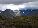
I climbed the last few meters to the flat "top", and as I walked over it a wide smile grew on my face – Njoatsosvágge, one of the most spectacular valleys in Sweden, lay literally before my feet. I found it every bit as impressive as it is purported to be; the mountains in question are not really that high, but their precipitous sides make them appear even more imposing than they are in the first place. I continued a little ways down the eastern slope so as to put some terrain between me and the wind, and then sat down among some rocks to have lunch at 12:15. I used the sleep mat for further wind protection, put on the gloves against the cold, and then let myself be spellbound by the lofty vista. Then I went to the actual summit of Skiejákvárásj, which gave a somewhat better view down the length of the curved valley; there was a footpath going straight across the top, so obviously I wasn't the only one who had had that thought.
The time had come for me to make a decision regarding the remaining part of the tour: pass through Sarek towards Kungsleden, go north towards Ritsem, or south back to Kvikkjokk. While the current sights of course were a huge incentive to continue, I had other things to consider. First, there was the weather forecast the Tuottar warden had shared: the cloudy, windy and rainy weather was to go on for two more days – precisely the two more days I needed to clear the "critical portion", and should conditions deteriorate further it wouldn't be much fun taking that route anyway, what with the lack of sights. There would also be four sizeable fords to pass, and such things are never fun – or even advisable – to do in rough weather. Finally, I had been experiencing a sense of mild mental fatigue lately, and I wanted to be alert in order to perceive Sarek in full.
Now, the importance of each of these things should not be overestimated – I certainly did not doubt my or my equipment's ability to weather the weather, so to speak, and I doubt very much that the streams in question would have presented much trouble, seeing as how water levels were so low across the board, and just the feeling of being in Sarek may well have invigorated me. No, what was more worrying was that during that short walk to the Skiejákvárásj summit, the hip ache had flared up again, and should worst come to worst and a significant portion of my body become immobilized, I would rather have it happen on or near a trail. Furthermore, I'm not really one to do things just to "have them done" – I generally don't climb a mountain to defeat it, but to earn the views its summit can offer, and drawing on that analogy I had already gotten much of what I came for (the western end of Njoatsosvágge is arguably the most beautiful and interesting). All in all, after careful deliberation, I resolved to go south.
The wind was now very strong, so I kept the gloves on as I started back down the western side. After passing the fence I turned south, cutting across the slope in the direction of the larger Vássjájávrátja lake. It was stony at first, but going soon became much easier, and eventually the ground turned into very nice grass meadows with a few flowers. There was a large blue hole in the cloud cover straight ahead, but even though the sun came out in full it gave no real warmth at first. Once I reached the lake it was obscured again, however, and I sat down on a large cairn of sorts to rest a bit. I then had to follow the stream that flows out from the lake a bit downstream before I found a place where I could ford it – this took place at a spot which was marked by another cairn, and getting across was moderately easy.
I proceeded up and around the rise south of the lake and came to its smaller companion, where I contemplated making camp. However, somehow it felt as though I hadn't walked long enough, or "done enough", that day, so after a brief delay I continued in the general direction of the Tarraluoppal cottages. I could clearly see a region of rain down there, but it was travelling south through Tarradalen, away from me. The terrain grew more hilly in the small scale, and when I came upon a small brook between two such mini hills at around 15:30, I felt that I had reached my goal.
There was a good, dry spot up on the nearest rise where I decided to pitch the tent. Before starting this, however, I walked on a little bit; the slope turned more steep right below my newly chosen camp site, which enabled a clear view of the cottages down in the valley. It kind of felt good not "having" to go all the way down there, preserving a sense of wilderness and seclusion. Well, not seclusion from reindeer anyway, as two separate herds of them chose the mire above the brook for a meet-up while I was working with the tent.
I again had some trouble with the direction of the wind, and some subterranean rocks complicated the placing of ground pegs, but I got it right eventually. The rain down in the valley, which for a moment had seemed as though it might send ambassadorial shreds in my direction, had passed on, and instead there was a bit of sun where I was. Things looked rather bad in the southwest, though. It was almost calm by then, but the weather had apparent problems deciding what it intended to do.
I started preparing dinner outside, watching another burst of rain sweep through the valley, and this time a few drops made their way up to my location as well, but it was nothing to be concerned about. There were some reindeer about again, and I could see a few people down on the trail as it rose out of the valley. The wind had turned, and was now hitting the tent at an angle, so it was hardly surprising that I had trouble earlier. Now it was the north which looked bad, but after the valley-rain had passed the immediate surroundings were still acceptable. Just the same, I ate inside the tent.
A bit later conditions deteriorated again, with rain and wind all around. I went on to study the map, trying to determine how I would structure the rest of the journey. I had some ideas, but the next day's weather would be the deciding factor. I then took an hour or so finishing the crossword, noticing that the rain had decreased to a light drizzle and a thin mist had appeared. I read some in my book to the sound of some more rain, and then it faded out completely. I looked outside to find the air calm and somewhat chilly, and it appeared to be clearing. I had my snack, during which there was another bout of light rain and a bit of wind, and at 21:30 I crawled into bed to read some more, with a final reflection that it was pretty fair to the north.


