Saturday 5/8

Rĺvejávrre – Viejejĺhkĺ (via Jiegŋáffo)
| Horizontal distance: | 13 km |
| Vertical distance: | +760 m, -860 m |
| Time: | 5 h 45 min |
| Lunch break: | 30 min |
| Dinner: | Swedish lobscouse |
| Night accommodation: | Tent |
| Stage classification: | Easy/Medium/Hard (comment)
This is a composite rating – the walk up to and down from the "pass" was Easy to Medium, whereas the Jiegŋáffo climb was Medium to Hard.
|
The night was somewhat chilly, but not enough to disturb my sleep to any significant degree, and the morning was quite warm. There was only a very light wind and no clouds whatsoever, but the number of mosquitos had apparently grown exponentially during the early hours. I had breakfast under the watchful eyes of a small group of reindeer on the other side of the stream, and then relaxed in the stillness.
I left after 09:15, bare-chested again, following the brook upstream. It was rather warm, but going was easy even though it involved some minor crisscrossing, and during this I unknowingly passed into Padjelanta National Park. A bit up the slope I came upon some cairns, which although there was no real path most of the time clearly marked a trail of sorts – perhaps one used by the reindeer watchers in going to their huts up on the cliff. I followed these cairns, which kept me at a "safe" distance from the stream; this was one instance where the map wasn't that accurate, since there were several other occurrences of running and stationary water than what it claimed there would be. That area was rockier than the initial slope, but progress was still unproblematic – I suppose that it might well have been hazardous in heavy rain, though.
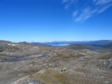
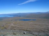
Once clear of all the hindering pools and puddles, I turned towards the saddle between the eastern ridge of Jiegŋáffo proper and the height 1314, a route that looked easy enough. That it was, but a bit more care had to be taken than before. When I reached the pass point, a great view of western Badjelánnda opened up, with the large lake Virihávrre as the dominating feature; this lake is frequently cited as the most beautiful lake in Sweden, and far be it from me to challenge that status. I walked down to the stream seen in the penultimate image below – which was not marked at all on the map either – and paused for lunch after 11, in the midst of a scattered herd of reindeer.
The reason I chose this particular route was that I wanted to mount Jiegŋáffo – the mountain is fairly high with its 1836 meters, and due to its somewhat isolated location, with all of the Badjelánnda lowlands stretching away to the north, it is an excellent observation site. As an example, it is a purported fact that on a clear day, one can see the Atlantic Ocean far to the west from the summit. Hence, after eating and resting for a bit I left the rucksack and started climbing, passing a number of reindeer in the process.
Even though the eastern ridge has a steep slant, making progress was not that difficult, and by planning out passages several steps in advance I was able to simply walk most of the time. There were a few segments of (easy) hands-on climbing, though, and then I passed over several snowfields, at various non-insignificant angles. Finally, I stopped beneath the largest of these fields, which extended almost to the top at quite a sharp incline. I could have pressed on, but the portion on or beside that snowfield before the last lofty climb to the actual summit looked tougher than it had been thus far, and seeing as how I still had several kilometers to go from my lunch site before I would be able to make camp, I decided not to go any further.
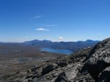
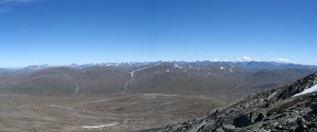
Not that that was a particularly hard decision to make, as the vistas available to me at my present location were just fabulous. The entire range of Sarek National Park lay on the eastern horizon; peak after peak in seemingly neverending succession. To the northwest and north were Norway, Virihávrre and central Badjelánnda, and far away to the northeast the mighty Áhkká massif rose above the heights in between. Also, in the image of Áhkká and Niják below, one can see a small, fuzzy white peak in the very remote distance just left of the boulder-like Niják – that is the top glacier of Giebmegáisi, the highest mountain in Sweden, some 110 kilometers away. Since I never made it to the top there was no Atlantic this time, but that did not bother me one jot as I stood there looking out over two national parks.
While having some chocolate and admiring the views, I turned on my mobile phone, just for the heck of it – and was thoroughly surprised when it established contact with the Swedish network. I immediately started composing a text message, but by the time I was done the phone had lost the signal. I left it in search mode, though, and then began the descent. I took a somewhat more direct route back down towards the rucksack, cutting over more snowfields. In the middle of one of those the phone indicated a connection, but also this time it broke off again before my message could be transmitted.
After an initial portion of careful climbing, the rest of the descent was of the same type as the ascent had been, so reaching my little camp again was a largely uncomplicated affair – especially since I had been able to make out the rucksack with my naked eye throughout the entire climb. There was no further net contact during the walk down, so I turned off the phone and put it back into the pack. I rested for half an hour before continuing, having some chocolate and reindeer meat; there was also a wind blowing, and some whisps of cloud were approaching the sun.
At 14:00, I started walking down into Viejevágge. The first bit was stony and somewhat difficult; the terrain was so broken up that I often found myself at a vertical drop of several meters and had to make a detour. During this part it was also less windy than up in the saddle, so there was the added burden of warmth. After a while I reached another line of cairns – obviously the northern continuation of the one I had followed in the morning. This time, however, I walked straight across it, continuing down the slope in a northeastern direction. The intermittent ledges also continued for some time, before giving way to a steep slope overgrown with moss, which in turn gradually changed into a mix of grass and heath as the slant grew more moderate; there the wind had returned as well.
I had chosen my heading for a specific reason: Viejejĺhkĺ has gouged out three individual canyons during its course through the valley, and I aimed for the topmost one, as I would be going downstream the next day. I reached the stream just above the canyon after 15:00, and went in search of a good camp site. I thought I had found one at first, so I dumped the pack, but then as I explored the canyon more closely, I came across a much better one directly above the deep crevice, and I went back to retrieve my belongings.
The sun was hot on the land and tent, but since there were no mosquitos present I could ventilate the latter rather well. I took it easy, observing a white layer of apparently very high altitude spread from the southwest. It eventually expanded in front of the sun, which cooled things off a bit, but it was not a full occlusion. I noticed a light ache in my right hip, but it was much too faint to worry about – yet. Instead, I made dinner, which I ate outside while a swarm of some smaller kind of insect buzzed silently around me. After the meal the sun broke through once more, and even though the tent was warm, it was tolerable.
I rested and played some solitaire, and before too long another, thicker, layer masked the sun more efficiently than before. This time the sky was more fully covered as well, but there were some blue spots still. I continued to relax, and finished the crossword, and the clouds developed into a plain cover with some cracks in it. This made for comfortable outside temperatures, especially since the wind had subsided again. I solved some more crosswords and then had my evening snack, and it looked as though the overhead clouds were the eastern perimeter of a larger front that was travelling to the north; the sky directly above had already started to clear. I entered the sleeping bag at 21:45 and then read for a while.


