Thursday 10/8

"Tarraluoppal" – Ruonasvágge
| Horizontal distance: | 19 km |
| Vertical distance: | -120 m, +260 m, -100 m, +120 m, -180 m |
| Time: | 6 h |
| Lunch break: | 30 min |
| Dinner: | Curry chicken and chocolate blueberries |
| Night accommodation: | Tent |
| Stage classification: | Medium |
| Map point: | Darreluoppal |
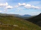
The early morning was a bit cold, and I put on an extra t-shirt for the final hour or so. I awoke again around 7, and got up a while later; the sun was shining from a blue sky and it was perfectly calm, but there were dense cloud sheets in the southwest. I went outside to have breakfast in the beginning warmth – and beginning wind – and I observed the morning passes of the Stáloluokta chopper again as I struck the tent. Before the time was fully 09:15 I had packed up everything and set off down the slope, heading for the cottages below.
The further I descended the more bushes and low vegetation appeared on the ground, and the final bit to the buildings I followed an old and partially overgrown path through the thickets. There were people present in some of the cottages, but none seemed in the process of leaving. I stopped to dispose of the garbage I had produced since Tuottar and paid a visit to the privy, and then I continued along the southbound trail, where progress was very easy. Some more clouds had entered the sky, and the sun was slightly dampened by the thinner of them, which in conjunction with a moderate wind made walking comfortable. Suddenly I became aware of a large bird circling above me, and I identified it as a falcon; it perched on a rock not too far away, but unfortunately it was too far away to get a good shot of it, and it lifted again before I could get any closer.
Since I did not wish to follow the exact same way back – which I would have to do if I stayed on the trail, eventually coming back to the branch point where I had turned towards Vaimok on day two from the north – I had an alternative in mind. The famous Swedish botanist Carl von Linné (Carolus Linnaeus) made an expedition to Lapland in 1732 to catalogue the plant life of the northern regions, including the fjelds. Among the places he visited was Kvikkjokk, wherefrom he proceeded to Stáloluokta via a route later to be known as Linné's Ruote, or the Preachers' Path as priests followed that way when going to the Alkavare chapel by Álggajávrre in western Sarek, where a mining operation had been started in the 17th century.
Instead of jostling his way through the thick vegetation of Tarradalen, Linné went through Vállevágge east of Darregájsse proper, and came down a bit south of Darreluoppal. This was the way I was about to take as well, but from the other direction, so after passing a brook about a kilometer before the trail would touch by Darrejĺhkĺ (soon to be Darrhaädno) I turned up the eastern slope, aiming for the small pass from which Buokkekjĺgĺsj flows.
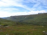
There were faint traces of a path at first, but as the incline grew steep it vanished. I cut across the slope, which was easy enough, even though there were some thickets of varying height and density – nothing that really worked as an obstacle, however. I passed another brook ravine very similar to the one from the day before, and after that I noticed a few cairns below me – they didn't form a distinguishable continuing line, though, and there were no signs of a path either, so I thought nothing more of it. I reached Buokkekjĺgĺsj at the place where it has formed a small pool, and then followed it upstream – at a distance, as required by the lay of the land. When I reached another small pool close to the pass point shortly after 11:45, I decided it was time for lunch.
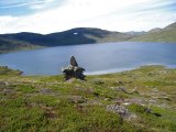
The white sheets above were pulling themselves apart, but the amount of cumuli was increasing to compensate. As I proceeded up the final part of the slope I discovered that the pool I had paused by was but one of several, lying at semi-regular intervals a bit further upwards. I passed south of the larger pool on the other side of the crest, stepped over its minuscule outflow, and then headed for the stream coming from Bajep Buojdes, which I went across at a place where it flowed entirely underneath a rock field. I then started to circumvent the sizeable lake Buojdes, utilizing a footpath that showed itself on and off, but when it was visible it was clearly defined enough to be made by human feet. It was rather easy at first, path or no, but during the latter portion of the northern passage the terrain took a turn for the worse, and the path, where found, was of some help there.
Towards the eastern end of the lake, however, the land changed into nice grassland, where I lost the path entirely. I passed the outflow of Buojdesjĺhkĺ without effort, and immedately thereafter the path reappeared, clear as ever. It didn't last, though, for it quickly faded out again when I started picking my way up the southern slope, heading for another small pass east of Slihtavárre. It was a bit stony going up, and quite hot as well, but easy all the same. About halfway up I heard a helicopter approaching, and soon it flew past through the basin, in a westward direction – perhaps the pilots vary their course, or it might have been some other expedition entirely.
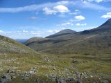
Up by the small tarn that lies in the pass it was rather windy, and the path suddenly sprang back into existence with a vengeance; seldom have I seen such an unmistakable directional guide in the ground. But, just as before, it withered out into oblivion after only a short distance. Just then I saw a large reindeer not far ahead, which was the first one I had seen all day; that felt somewhat unfamiliar considering the experience of the past few days.
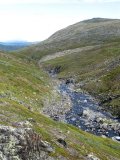
I followed the contour of the undulated landscape of Slihtavágge so as to minimize vertical displacement as I continued towards the next pass west of Ruonas. I came up from the west and then passed east of the two pools in the saddle itself, and continued down into Ruonasvágge in a southeastern direction. That slope was fairly steep at places, and there was yet another faint-path-which-ended, after which I turned down towards the stream at the bottom of the valley. The sides of this stream were also rather steep (and uneven), so suitable camp sites were somewhat hard to find, but I was fortunate enough to walk straight onto a patch of level heath up in the slope, where the pattern of stones strewn about clearly indicated that someone had camped there (long) before. Since this place was also adjacent to a small but steady tributary trickle, I ended the stage of the day there at around 15:15.
Ruonasvágge is a small valley that cuts into the raised land that separates Tjuoldavágge from Tarradalen, and due to this the view east is very vast. One is sufficiently high that Tjĺrok is no occluding element, and the landscape beyond is fairly low in comparison, with Gállakvárre and Gábllá as prominent distant features. Clouds were amassing from the southwest and there was an easterly wind blowing, but it remained rather warm. I changed the memory card in the camera and then went to pick some blueberries – I had managed to pick a spot with quite a lot of them all around. A cloud slipped in front of the sun during this undertaking, which enabled me to spend some time inside the tent when I was done, playing solitaire and munching on my reindeer meat.
I prepared dinner as well as an improvised dessert made up of chocolate and blueberries, which turned out rather well. Afterwards the cloud in front of the sun attenuated until it finally drifted off entirely, and since there was next to no wind it was very hot for a while. I replenished my berry supply and then read in my book outside in the shadow of the tent. Later another bank of clouds approached from the west, enveloping the sun again, and I went inside. Dark clouds kept pouring in while I struggled with a crossword or two; soon there was a substantial cover overhead, and a few raindrops began to fall as the wind increased.
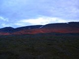
This turned into a continuous rain which kept at it for a while, but then it seemed to diminish. That was, however, only a ruse, for without warning or provocation it returned many times as forceful as before. I read inside, listening to the rattle of the rain on the canvas, which again appeared to be receding after some time – and then it stopped for real. The cloud system responsible was heading towards the east and the parts remaining above were decidedly thinner; things looked better to the south, but worse to the north. Since it was evening I had my snack, and it became apparent that there would be no further rain; the clouds broke apart, letting the setting sun paint the towering mountainsides of Darregájsse a crimson red. It was still warm and only a light wind was blowing when I lay down to read at 21:45.


