Sunday 28/7

Måskoesvaajja – Viterskalet (via Måskonåiveglaciären)
| Horizontal distance: | 11 km |
| Vertical distance: | +280 m, -100 m, +60 m, -40 m, +140 m, -540 m |
| Time: | 5 h |
| Lunch break: | 1 h |
| Dinner: | Risotto with dried sausage/reindeer meat |
| Night accommodation: | Cottage |
| Stage classification: | Hard (comment)
Very hard, in fact. That climb up from lake 1195 was not to be trifled with!
|
| Map point: | Viterskalet |
I had rather a good night, with markedly lower temperatures than previously, and got up at 07:00. The sky was clear with a few high banks of cloud which at the moment partially obscured the sun, and there was a light easterly wind. After admiring the nice morning presentation of Måskoesvaajja for a while I had breakfast outside, and made no particular haste in packing up either. However, when I was almost finished clouds had started forming at the peaks, but it seemed a half-hearted effort (so to speak) at best. I used the anti-chafe adhesive to fashion some protection for the backs of my hands, which had suffered quite a bit of sunburn what with my holding the walking stick all the time, and then left at 09:30, wearing the hiking trousers now that I would be going mountain climbing and all.
I went up the slope at a slight angle from the stream, noting both that the rucksack felt quite light and that the clouds were already dissipating again. As I proceeded further into the hollow it became apparent that my initial judgment of the steepness of the snowfield had been correct, and even though a traversal would probably have been possible I saw no reason to risk a fall when there was a more or less simple circumvention readily available. It was still and very warm as I climbed the outrunner diagonally, using reindeer paths here and there, and then went out to the eastern edge to get a vertiguous view over the valley below. The next bit up was steeper and rockier – and windier – and I did my best to wind my way between the larger rocks, but had to enlist the help of a hand or two in a place or two.
Once I had reached the next crest the ground was very easily trodden as well as clearly marked by reindeer having made the same discovery. I went out to another edge for another dizzying look down, and after sending an SMS with an updated tour plan (just in case) I turned west, walking briskly and easily across mostly level ground above the snowfield and the rocks immediately next to it. Having passed above another tongue of rocks I then started the gentle descent towards the little tarn beside 1292, where the ground was mostly stone-strewn grass and moss.
As I got closer I saw that lake 1195 was partially covered in ice still, and a quick visual inspection of the rocky rise between this lake and the glacier lake beneath Måskonåiveglaciären was encouraging, with several apparent possible routes up. Closer to the tarn it was stony and wet, and I then followed a section of rocks which landed me at the outflow from lake 1195. There was quite a bit of water in this stream, melting as it was, but getting across was easy with the help of all the rocks present. I then started tracing the northern side of the rise, walking on sharp, loose and more or less steep rocks that necessitated a great deal of care, but no actual worries so far.
I had been aiming for a somewhat simple-looking passage that started with a small snowfield right at the water's edge, but now it was clear that in order to reach it I would have to climb around a (short) section that dropped steeply into the water, which given the looseness of the rocks constituting the slope was not that attractive. Instead I opted for a narrow fissure-like formation that cut across the slope, which was also rather steep (and its rocks still loose), but with the same or an increased amount of care I made steady progress, at times intentionally dislodging a rock or two first to secure my footing.
I then reached an area of slanting flat rock faces, which were convex to boot, and here I simply dared not continue since a slip there would unceremoniously dump me straight down into the water, and the sharp rocks there, a by this point considerable distance below. Having overcome the immediate bout of actual fright this created I backtracked to the fissure, continuing the climb to its narrowing upper end on increasingly loose and steep rocks, with increasing carefulness to match. The actual end consisted of another flat rock face, complete with a bit of dripping water, but here I could get a good manual grip on the actual cliff and heave myself past this final obstacle.
Having done so I took a moment to breathe, but I did not quite relax just yet since the incline was still appreciable and the rocks still loose, but I was now above a sharply defined crest and could simply walk, albeit not leisurely. I zigzagged my way further up and then kept to the eastern side, going below the summit of the rise, and was granted very good views over Måskoesvaajja far below; it was a very airy feeling. As I rounded the summit the rocks gave way to grass and moss again, and now I could walk leisurely for a bit until it was time to find a way down to the next lake. That slope was also convex so I couldn't see the whole route from the start of the descent, but as it turned out the nice ground continued all the way down, and not very steeply either. Having reached the next outflow I stopped for a pause, having now succeeded in negotiating all obstacles on the day's route that could potentially have been (and nearly were) unsurmountable.
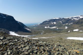
The view of the lake and the glacier was a cool one, in several senses, even though the little icebergs that I've heard often break off and float on the water were absent at the time. Having relaxed and photographed enough I crossed the outflow, also this one having lots of water and enabling large rocks, and then proceeded over to the edge of the snowfield that extended eastwards from the glacier proper. I kept to said edge as I went up zigzag fashion since I did not know just how far the actual ice extended, kicking my boots into the snow with each step to secure purchase; it was fairly steep, but not overly so. Further up, where the field extended a narrow tongue upwards, I crossed it and walked across an area of rocks to the next snowfield, which was high, flat and thin enough that I just walked straight across it too.
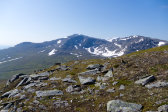
I was now in the saddle between peaks 1543 and 1500, where I walked east of the little icy pool and then kept a bit to the south as I started to descend again, where earth and moss started to appear between all the rocks. Måskoestjåhke was an impressive fortress straight ahead, and the wind, which had been absent for a while, was also returning. Below me the upper parts of Viterskalet were opening up, and when I reached a good rock formation shortly before noon I sat down to have lunch, having forgone the option to extend the stage to include N Sytertoppen since I was already fairly spent from the adventures of the forenoon.
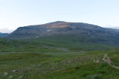
The rest of the way down consisted of rocks and dirt, plus a smaller snowfield, and then I found myself at the stream from the glacier between Måskoestjåhke and N Sytertoppen. This stream had a large snowbridge upstream, but not trusting that for a second since the water was quite swift I performed another walk-around-in-the-shallows type of ford right where it spread out widely as it started bending. After that I followed a long, low and quite dry rise which gave way to wet and stony ground as I rounded Måskoestjåhke. I proceeded up onto another, higher rise which gave a good view of Måskoesjaevrie, and then followed reindeer paths into and down a somewhat steep ravine that opened up to the lower parts of Viterskalet.
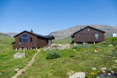
The next portion consisted of very nice and dry heathland where I soon caught sight of the Viterskalet cottages, and I could walk effortlessly for a while, being cooled by a pleasant and quite strong wind coming out of Syterskalet. Then grass started taking over, which in turn soon got wet as I neared the marked trail to/from N Sytertoppen, upon which I saw no people. As I reached and turned onto this trail I found it well marked and trodden, but also somewhat muddy before things dried up and turned meadow-like. I could now see Kungsleden again, in close proximity to which there were a number of tents (and people). A bridge had been constructed over V Syterbäcken since my last visit, but the new path leading over to it was still not as clear as the old one leading to the previous fording location. I took this bridge around 14:30 and then walked the last short bit to the cottages upon the much more well-trodden Kungsleden.
One of the wardens was just heading down to the stream to wash some clothes (yes, here too), so I waited on a bench outside while her colleague finished lunch. A Swedish-speaking Swiss woman arrived from the east in short fashion, and once said lunch was over we all went inside the service cottage to check in and talk a bit. Two hikers with a chihuahua(!) also arrived as did two friends of the first warden, who was now back, and while all of them remained outside I moved inside the guest cottage, which was of a markedly different but quite nice and smart make. It also included an actual washing room with one of those buckets with a shower handle attached, so I heated some water and had a proper wash after yet another warm day. I then walked around a bit outside in the pleasant wind, noting the presence of more people, and then returned inside to prepare dinner and talk a bit with the two warden-friends.
After dinner I sat out on the porch, from where I espied a single woman fording V Syterbäcken straight across from the cottages, and this turned out to be a third warden who had apparently been out on a day tour. The cottage was acquiring more overnight guests, and more tents had been erected beside the ones already present when I arrived, so it was a stark contrast to the solitude of my past several days. I read some out on a bench in the sun, and then on one in the shadow, which was decidedly cooler (and windier), and finally in the sofa in the kitchen. Here I also talked a bit with a newly arrived man, who was also a warden but was now on a Gröna Bandet (Green Ribbon) tour, going north. More reading out on the porch followed, where the weaker evening sun provided comfortable conditions, while more people arrived.
An evening walk in the vicinity followed before the sun sank behind Daalåejvie/Klovnjebaektie, and then I read some more in my bed. By this time the kitchen was nearly full, including a man with a white cane(!), but I had no trouble fitting my evening snack in. It was still windy outside, and the partially open window made for cool temperatures in the bedroom, which felt good. A fair amount of clouds had quickly rolled in as well, and N Sytertoppen was now just hidden. Most people were drifting off to bed or preparing to do so, and I did as well after 22:00.


