Tuesday 21/8

Såmmártjåhkkå
| Horizontal distance: | 11 km |
| Vertical distance: | +940 m, -940 m |
| Time: | 5 h 15 min |
| Lunch break: | 1 h |
| Dinner: | – |
| Night accommodation: | – |
| Stage classification: | Hard |
When I got going it was warm and very fair, with some high streaks of cloud in the form a large feather that spread out from the west. I continued upwards in a straight line when the path turned to the south, making my way through some bushes until I reached the stream from Såmmárgårsså, which was easily crossed. On the other side there were some more bushes, but then I found a path – I did, however, only walk a few paces upon it, for it emerged at the stream just where the cleft started to get deep, so I turned up the slope instead.
I climbed through a region of low and not very dense shrubs to a large rock field, where the size of some of the boulders made progress somewhat tricky. Having cleared the rocks I climbed an even steeper slope with more low shrubs, using the sturdy plants as handholds to aid my ascent, finally reaching a small hill of sorts made up by large boulders. This I went straight over, jumping from rock to rock in a light wind which had just picked up, and in the sky the cloud feather was turning its tendrils towards the south.
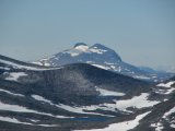
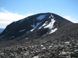
An easy portion of mostly grassland strewn with stones followed as I walked up onto the crest of the long slope, continuing high above the cleft until I reached a small ravine of a brook coming from the south. The celestial veil had now passed in front of the sun, which made for more pleasant walking conditions as I kept on going upwards, cutting across the northern slope of Såmmártjåhkkå after the ravine. At first the ground consisted of grass and going was easy, but the higher I got the more numerous the stones became, and eventually I turned straight up where the terrain seemed better. This it was, and it soon also started levelling out...
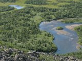
...and very suddenly I found myself at the verge of a tremendous precipice overlooking Tarradalen far below my feet. I walked around for a while, immensely enjoying the views and the acute sense of loftiness they infused – I could see large sections of Padjelantaleden down in the valley, but even though I scanned its length with my binoculars several times I detected no human presence anywhere. At 12:30 I finally sat down right there on the edge to eat, with the extraordinary vista in front of me. There were a few gusts of wind while I sat there – which I did for quite some time – and the sun was still dimmed. Then I got up and walked around taking photos, during which the opposite motions of the feather and the sun brought the light back to full intensity.
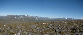
When I got going again I aimed for the saddle between Måskásjgájsse and Såmmártjåhkkå proper, which was still some distance away. Since there was a bit of wind up there on the heights I walked with the wind jacket on, and soon the upper parts of the huge cleft of Bádurgårsså came into view. I went over to the edge to get a good look, seeing all the way to Darrávrre in the remote distance, and then I walked a little bit to the east before turning back north to where the incline grew steep; at this altitude there was nothing but rocks to tread on. I maintained my elevation along this edge as I went westwards, and the further I got the larger the areas of non-stones became. I had a very good view of Ruonasvágge before I started descending for real, zigzagging my way down on what was mainly grass, feeling the toll it was taking on my knees.
This route brought me down into the small valley between Såmmártjåhkkå and Sivvátjåhkkå a bit below where I had passed on the way up, and after crossing the little ravine I continued on a lower course. I passed north of the rock-hill, which despite the slant was much easier, and when the vegetation started I kept close to Såmmárgårsså – I was still making good progress, but it came with a bit of an effort now as it was getting steeper. I also tried to circumvent the lower rock field, but that turned out to be a bad idea – I ended up in a very awkward position from which the only escape was a precarious actual climb up a wall of boulders. When after a bit of a struggle I had overcome that obstacle the continuation was also anything but simple, and through it all the brilliant sun together with the physical exertion made everything hot indeed.
Ultimately, though, I emerged on the path I had found earlier, and I decided to follow it downwards to see where it led. It grew fainter with every step but it remained discernable for quite some time, although eventually not even the pattern recognition wetware of my imagination could make anything out. This was in a region of thick juniper copses, and getting past it was a hassle, but then they started getting sparser and before I knew it I stepped onto the trail just south of the two adjacent bridges (only one of which is marked on the map) – thus the last half-kilometer or so went by quickly, returning me to the cottage at 15:45.
« Return to Såmmarlappa report


