Sunday 3/8
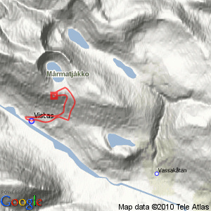
Vássačorrojávri
| Horizontal distance: | 7.5 km |
| Vertical distance: | +740 m, -740 m |
| Time: | 4 h 15 min |
| Lunch break: | 45 min |
| Dinner: | – |
| Night accommodation: | – |
| Stage classification: | Hard |
I walked past the privy and took the brook path up to the first shelf, where I found a multitude of ripe cloudberries, so I ate some as I strode past. I left the little path before it got to a boggy area and went up the slope on my own, which was mostly easy. The sun had passed into thick veils which was not a bad thing since it was very warm anyway, but there was also an increased level of distance haze in the air. The last bit up to the main path consisted of nice heath, and I quickly reached the stream which had much less water in it now than when last I crossed it.
After the last of the dry courses I turned up the slope, soon reaching the base of the main rise. This was good at first, but then it got really steep with rocky grass, and I needed to enlist the help of my free hand at times. The slant was such that I naturally gravitated into the adjacent ravine, where progress was somewhat easier (or, rather, less difficult), and I climbed out of it again on better ground as the sun shook its celestial shroud.
The next portion was very tricky, with loose rocks covering the steep slope, and I had to use my hands more and more to feel secure. A somewhat better stretch of flatter rocks took by, after which it was back to loose ones, and it was really tough – the small pack I carried did not affect my balance, but had I had a larger one I would have turned around a long time ago by then. Really, I can confidently say that this was the hardest thing I've done in this respect (at least up to this point). After some shifting ground conditions I finally reached the top of the slope, making my way over some strips of grass and more loose rocks to the large flat expanse before Vássačorrojávri. Phew!
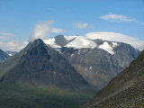
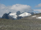
I kept to my right a bit as I walked into the niche; the ground consisted of nothing but rocks here, but progress was easy enough. The niche itself was imposing, but it took some time before I caught sight of the actual lake, pretty large as it was. Turning west again I noted that Nállu had the appearance of a rhinoceros from this perspective, and as I approached the edge more and more of the peaks and valleys came into view. I had to descend several more short rocky slopes before I reached the actual rim, but I stopped a few meters in for safety reasons, sitting down for lunch after 11:45. It was still a bit misty all around, and both the sun and wind made on-and-off appearances, but it was never chilly. I did go down a little bit more – carefully – for a few dizzying looks (and photos), and then started walking again when the air seemed lighter.
I followed the weakly defined ledge I was currently on slightly upwards, and then went down to the start of the closest ravine – the map had the stream running all the way here from the lake, but in reality it flowed underground until emerging a bit further down in the cleft. Since I needed to refill my water flask that is where I went, and once there I entertained the notion of using the ravine itself as a descent route, since I wanted to avoid going down the same way I had come (yikes). From where I stood it did look doable, so I decided to try it out. I employed a snowfield at first and then came onto small-scale scree, but this was still better than the larger rocks further east – a reliable state of unreliability, as it were. I crossed the little stream a couple of times, seeking out passages and areas that looked easiest, eventually coming to a stretch of stony grass on the western side which after some winding to and fro gave way to drier heath.
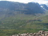
With that I was out of the ravine, and the ground gradually levelled out, which was good since my knees had really started to feel affected by the constant slant. I passed through some low shrubs and then came onto the path just above some larger osier thickets, where it constituted the best passage. I walked leisurely, having saved a fair bit of time (and effort) with the ravine descent, and it was also much warmer now. I rounded the wet patch and still on the path continued down into the dry forest, which opened up in several clearings that let me survey the cottages from above. The last bit of the route felt longer than I recalled, but again I was in no hurry, and it was no later than 14:00 when I returned.
« Return to Vistas report


